|
Home
|
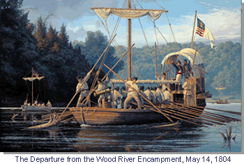 Images
courtesy
Gary R. Lucy
Studios
Images
courtesy
Gary R. Lucy
Studios
|
This website serves geographical information and maps that are products of the LEWIS AND CLARK HISTORIC LANDSCAPE PROJECT that has been conducted at the Geographic Resources Center (GRC), Department of Geography, University of Missouri in partnership with the Missouri State Archives, Office of the Missouri Secretary of State. With the primary goals to geo-reference, digitize, and map all of the retrievable information from the Lewis and Clark journals and the 18th and 19th-century land survey notes along the Big River Corridors of the state of Missouri, this effort should serve as a significant educational contribution to the national commemoration of the Lewis and Clark Bicentennial (2003-2006). Specific campsite maps, photo-realistic images of important river landmarks, animated virtual Missouri River travel, and an interactive map server offering various layers of geographical data on the Expedition's outward and homeward journeys joined with the natural and cultural history of the Missouri River corridor are all currently offered here. We hope your visit both informs and excites your geographical and historical imaginations on the Missouri of old. Available Now!  |
|||||||||
|
|||||||||||